Warm Springs Indian Reservation
| (HOME) | (RETURN) |
|
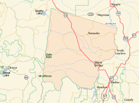
Introduction The Warm Springs Indian Reservation consists of 1,019.385 sq mi (2,640.194 km˛) in north central Oregon, in the United States, and is occupied and governed by the Confederated Tribes of Warm Springs. Three tribes form the confederation: the Wasco, Warm Springs and Paiute. Since 1938 they have been unified as the Confederated Tribes of Warm Springs. Description The reservation was created by treaty in 1855, which defined its boundaries as follows: Commencing in the middle of the channel of the Deschutes River opposite the eastern termination of a range of high lands usually known as the Mutton Mountains; thence westerly to the summit of said range, along the divide to its connection with the Cascade Mountains; thence to the summit of said mountains; thence southerly to Mount Jefferson; thence down the main branch of Deschutes River; heading in this peak, to its junction with Deschutes River; and thence down the middle of the channel of said river to the place of beginning. The Warm Springs and Wasco bands gave up ownership rights to 10,000,000-acre (40,000 km2) area, which they had inhabited for over 10,000 years, in exchange for basic health care, education, and other forms of assistance as outlined by the Treaty with the Tribes of Middle Oregon (June 25, 1855). Other provisions of the Treaty of 1855 ensured that tribal members retained hunting and fishing rights in the "Natural and Accustomed Area" which they had vacated. These treaty hunting and fishing rights are rights that were retained by the tribe and are not "special rights" granted by the U.S. government. In 1879, the U.S. government moved a small group of Paiutes to the reservation in spite of that tribe's history of conflict with Columbia River tribes. (Courtesy of the Wikipedia) |