Summary:
Press CTRL + P to print. Photos do not show when you print this page. (Help)
This hike begins on Forest Road #2110. The trail follows
an old logging road for a short distance before it begins a
very steep descent to Glacier Creek in the valley below.
As you begin to descend you enter an Old Growth Forest.
Nearly all of this hike is in dense forest.
After reaching Glacier Creek, you don't cross it, but
rather begin a very steep climb to Glacier Lake. At
about 1 mile you may notice the sound of the creek
changes. This is because Glacier Creek simply begins
by pouring out of the ground very near the trail. Keep
and eye and ear open for this unusual phenomenon.
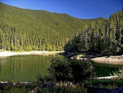
The reason for the unusual beginning of Glacier Creek is
due to the fact that Glacier Lake was actually formed
because of the collapse of the surrounding mountains.
The debris filled up the canyon and the lake formed
behind it. The water from the lake varies greatly in
depth by season.
The lake has no outlet as such. The water just seeps
through the landfill that creates the lake, and all
of a sudden appears as a creek.
This is a relatively short hike, but a bit steep.
It would be very difficult if the trail was wet.
The following images are random samples of the wildflowers found in the Gifford Pinchot National Forest.
Mouseover image to view flower name, and click on image to jump to flower guide.
From I-5 junction with US Hwy 12
Travel east on US Hwy 12 for about 48 miles to Randle.
From Randle travel east on US Hwy 12 for about 13.3 miles to the junction with
Forest Road 21. Turn right (south) onto FR21 and follow it uphill for about 5 miles.
At this point you will see Forest Road 2110 on your left, which is the road to the
Glacier Lake trailhead.
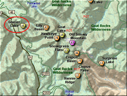
Click on the link below to see a map taking you to the trailhead.