Summary:
Press CTRL + P to print. Photos do not show when you print this page. (Help)
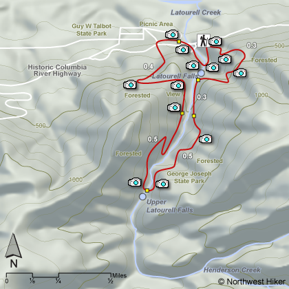
This hike is the longest in the Latourell Falls area. One
can follow the trail either clockwise or counterclockwise.
However you choose to hike this trail, use extreme caution as there
are very steep cliffs and drop-offs along the area near the lower
falls. The trail meanders through forested areas to a smaller
less imposing falls before returning to the parking area. The
hike takes you through a picnic area north of the Old Columbia River Highway.
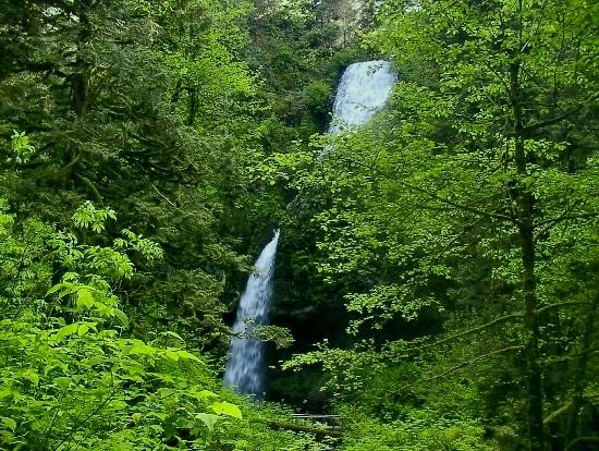
Access to an area known as George Joseph State Park, which is located
above Latourell Falls, is possible by using the trail from
Latourell Falls and Guy Talbot State Park. A trail leads from the parking
lot to the top of lower Latourell Falls. Beyond this point on the trail,
you've entered the enchanted forest of George Joseph State Park where
sword fern, moss and lichens are barely illuminated through the dense
stands of timber. Continue on the trail to a rarely visited wonder which
is upper Latourell Falls.
Guy Webster Talbot and his family used this property as a summer estate
until 1929 when they donated it to the state. Today, it's a beautiful
picnic park. A modern picnic shelter is available for rent (and is reservable).
While the park is terrific for a group or family picnic, the park is often
uncrowded even on the best days because of its seclusion. A gently sloping
grassy hill dotted with Port Orford cedars, Douglas firs, alders and maples
invites frisbee tossing and quiet relaxation.
The tiny town of Latourell (pop. 12) borders the north side of the park.
Homeowners ask that visitors please respect their privacy. A trail underneath
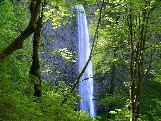
the Historic Columbia River Highway bridge leads directly to Latourelle Falls (250' tall),
only a few minutes away by foot.
|