Summary:
Press CTRL + P to print. Photos do not show when you print this page. (Help)
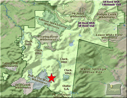
 Round Lake and its associated camp facilities are extremely run down. However, it appears
that various volunteer groups are doing their best to breathe new life into this special
get away.
Round Lake and its associated camp facilities are extremely run down. However, it appears
that various volunteer groups are doing their best to breathe new life into this special
get away.
The road was in very good condition, so getting here should not be an issue. The hike is extremely
short, and thus reaching the campground, which is actually a walk-in campground along the lake, is
also very easy. It is about a half mile walk, and uphill at first, to get to the lake's north shore.
The north shore is the most developed and offers the best camp sites. However, even though the trail does
go completely around the lake, well, it is in very poor repair.... especially the bridge across the outlet
stream.
I really liked this lake, and appreciated all the hard work volunteers have done to make this
a worthwhile destination. Every time I looked at the lake, I saw trout jumping. There is a
two fish per day limit, and I am sure you will have no problem reaching this limit with the
whole family.
 When I hiked to the lake in mid-July the Rhododendrons were in full bloom, and oh, what a treat.
No wonder they call the ridge above the lake Rhododendron Ridge. This kind of environment does
come with a price.... mosquitos. Yup, cazillions of them. So, simply come prepared during the
hatch, or come later in the summer and have less hassle. But, whatever you do... come and enjoy
this little gem tucked away in the back country of the Mt. Hood National Forest.
When I hiked to the lake in mid-July the Rhododendrons were in full bloom, and oh, what a treat.
No wonder they call the ridge above the lake Rhododendron Ridge. This kind of environment does
come with a price.... mosquitos. Yup, cazillions of them. So, simply come prepared during the
hatch, or come later in the summer and have less hassle. But, whatever you do... come and enjoy
this little gem tucked away in the back country of the Mt. Hood National Forest.
|