MOVE MOUSE OVER MAP CAMERA ICONS ( ) TO VIEW PHOTOS - F5 TO REFRESH ) TO VIEW PHOTOS - F5 TO REFRESH
A PICTURE IS WORTH A THOUSAND WORDS

TRAIL POSITIONED PHOTOS OF THE HIKE |
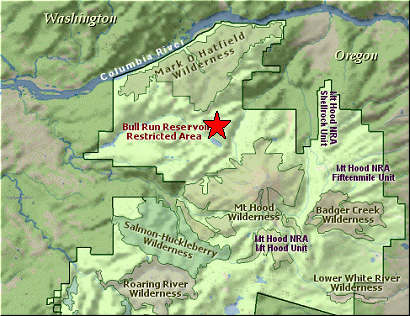
NOT TO BE USED FOR NAVIGATIONAL PURPOSES - ONLY FOR REFERENCE
 |
|
|
|
| Hike Length: |
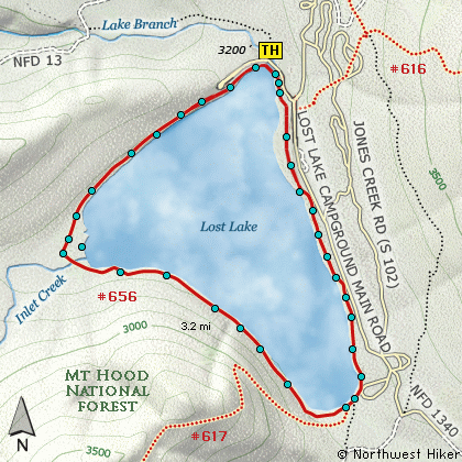
3.2 miles round trip |
| Elev. Change: |
10' gain |
| Hike Difficulty: |
Easy |
| Season: |
Summer thru Fall |
|
| Trail Condition: |
Excellent |
| Trail Access: |
Excellent |
| Trail Signage: |
Excellent |
| Features: |
Views, Wildflowers, Lakes |
|
| Useage: |
Heavy |
| Permit: |
Fee Required |
| Horses: |
No |
| Mtn Bikes: |
No |
|
|
Summary:
Press CTRL + P to print. Photos do not show when you print this page. (Help)
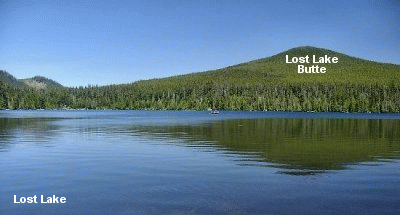
This hike around Lost Lake is a wonderful feast for the senses.
Whether the sky is clear or cloudy, the lake and the surrounding forest bring a
rich experience to those who hike this trail.
 Obviously, a person can hike the trail either clockwise or counterclockwise. This
description will follow the trail from in front of the Lost Lake Lodge and travel
counterclockwise, or to the west. The trail follows closely along the lake shore
and immediately crosses the outlet from the lake parallel to the paved access road.
The trail has its own wooden bridge.
Obviously, a person can hike the trail either clockwise or counterclockwise. This
description will follow the trail from in front of the Lost Lake Lodge and travel
counterclockwise, or to the west. The trail follows closely along the lake shore
and immediately crosses the outlet from the lake parallel to the paved access road.
The trail has its own wooden bridge.
After traveling a brief distance through a picnic area, you enter dense forest with
very large trees. The trail often is a wooden path raised from the ground to keep
the hiker high and dry. At times you can glimpse views out across the lake to Mt Hood
in the distance. Other times you are in swampy areas or again in dense forest.
As you travel around the lake the trail varies in quality. At times it is wheelchair
accessible, other times is it not. At times you walk right on the waters edge, other
times you can barely see the lake through the trees.
When you reach the southern most end of the lake, about 2 miles into the hike, you
will intersect Trail #617, which is an access to the Pacific Crest Trail #2000 high
above the lake. It is from this point on that the trail takes on a very high quality
and is wheelchair accessible the rest of the distance back to the parking area near
the lodge. From time to time there are little viewpoints built out over the lake
which offer excellent photo ops.
This is an excellent hike for the young and for those more seasoned citizens.
|
|
The following images are random samples of the wildflowers found in the Mount Hood National Forest.
Mouseover image to view flower name, and click on image to jump to flower guide.
|
Directions:
These directions take you from Hood River, Oregon.
Whatever direction from which you arrive at Hood River,
follow the sign of old US Hwy 30 into town. From the
west turn right on 13th Street and follow it up the
hill until it merges with 12th. If you are approaching
from the east, on US 30, turn left on 9th and follow it
up the hill until it merges with 12th. Either way,
follow 12th south out of town on what is called
Tucker Road or Hwy 281. About 6 miles out of town you
will cross the Hood River. Immediately after the bridge,
bear right and pass Tucker Park. In about another
six miles you need to bear to the right again following
signs to Lost Lake. This community is referred to as Dee.
As soon as you cross the railroad tracks, bear left and follow the signs to
Lost Lake. This paved road becomes Forest Road 18, and
you need to follow it about another 8.5 miles. Then
bear right on Forest Road 13 for another 4.5 miles.
Click on the link below to see a map taking you to the trailhead.
|
|
|


