Summary:
Press CTRL + P to print. Photos do not show when you print this page. (Help)
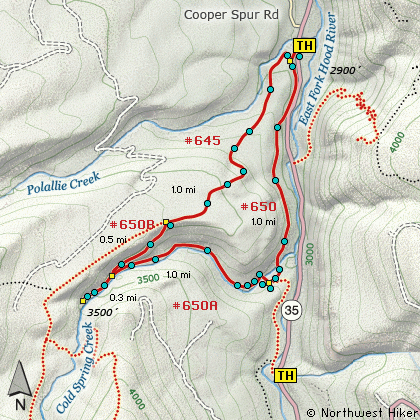
Excellent loop hike beginning on Trail #650 at Polallie trailhead.
The trail begins with a very steep climb right off highway 35, and soon intersects
Trail #645. At this junction leave Trail #650 which you will use to complete the loop,
and follow #645 to the right. The trail levels off a bit and wanders through dense
forested areas. At about 1.5 miles you reach the junction to trail #650B. Follow
Trail #650B downhill toward Tamanawas Falls. The trail remains mostly in dense forest.
Due to a bridge washout, a new user created trail leads you across a rocky slope and
connects to the original trail just a short distance from the falls.
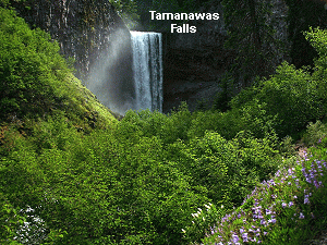
You have several areas to view Tamanawas Falls and all are outstanding. You can even
walk up to and behind the falls if you don't mind getting wet. Return by trail #650A which
follows Cold Spring Creek. This is a beautiful hike along a scenic creek. You will cross
Cold Springs Creek twice. First just before the junction with Trail #650 which also crosses
Cold Spring Creek and follows the East Fork of the Hood River back to the Polallie trailhead.
The hike is almost entirely in forested areas with only occasional views.
Tamanawas Falls is spectacular and well worth the effort regardless of the trail options
you choose.
The following images are random samples of the wildflowers found in the Mount Hood National Forest.
Mouseover image to view flower name, and click on image to jump to flower guide.
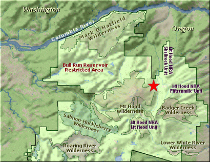
Follow Oregon Hwy 35 south of Hood River or
north from Hwy 26 near Government Camp until
you come to the road to Cooper Spur. Just
a hundred feet south of that junction on the
east side of Hwy 35 is the parking area for
the Polallie Trailhead. To access the trail
you have to walk across the highway, so be
careful.
Click on the link below to see a map taking you to the trailhead.