Summary:
Press CTRL + P to print. Photos do not show when you print this page. (Help)
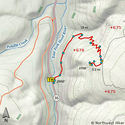
 This is an outstanding little hike with immense rewards. The trail used to begin at
the Polallie trailhead, but mother nature took care of that idea some time ago. Now
you need to go a bit further upstream where Hwy 35 crosses the East Fork of the Hood
River, and you'll see the trailhead sign off to the east side of the road. Not much
area to park, but normally adequate.
This is an outstanding little hike with immense rewards. The trail used to begin at
the Polallie trailhead, but mother nature took care of that idea some time ago. Now
you need to go a bit further upstream where Hwy 35 crosses the East Fork of the Hood
River, and you'll see the trailhead sign off to the east side of the road. Not much
area to park, but normally adequate.
Because the trailhead was relocated, the trail is new for about the first half mile.
You actually lose a bit of elevation at first, then after you pass where the old
trail begins, you start a very vigorous climb, thus the hike may be short but definitely
moderate in difficulty.
As you climb the ridge you will be offered a variety of environments. You'll be in
dense forest one minute, then in the open the next where you have a brief view of
the cliffs around you. But it is not until you reach the top that you receive your
true reward. When you summit, you'll be at an intersection of Trails #678 and #675.
You will follow neither of these to your destination. Instead follow the small path
referred to by a sign entitled "View". You will lose altitude now, as you descend
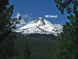
to the vantage point where you will have spectacular views of Mt Hood and Mt St Helens
to the north. Highway 35 is below you.
|