Summary:
Press CTRL + P to print. Photos do not show when you print this page. (Help)
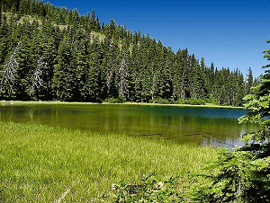
This is a short and easy hike. The hike begins to descend almost
immediately and drops along a hillside within a dense forest. This
short hike brings you to a lovely lake surrounded by timber and a lush meadow.
A clear little stream feeds the lake and flowers abound in season. The lake
appears to be rather shallow, but the day I was there I saw a fisherman out
in the middle of the lake in some kind of flotation devise, but I don't know
if he was having any success.
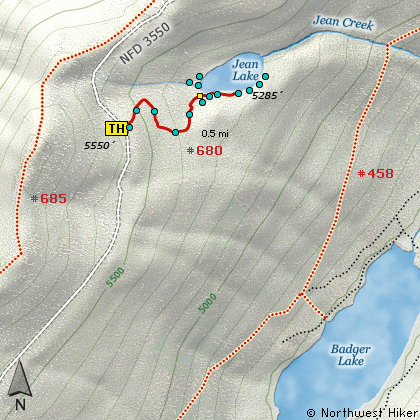
The most difficult part of this hike is getting to it. Forest Road 3550 is a challenge at best.
The following images are random samples of the wildflowers found in the Mount Hood National Forest.
Mouseover image to view flower name, and click on image to jump to flower guide.
If you approach this from on Hwy 35
going south out of Hood River, watch
for Road 44 to Dufur and points east.
Turn east on Road 44 and follow it for
about 3 miles to Road 4410. Turn right
on 4410 and follow for about 6 miles.
You will come to a junction where you
need to bear right on Road 3550. This
is a very primitive road, so be aware.
Follow this road another 5 miles or
so to the trailhead. The trail is on
the east side of the road and parking
is difficult.
If you are coming from Hwy 26 near
Government Camp, and traveling north
on Hwy 35, you will need to take
the Mt Hood Meadows Ski Resort exit
at Bennett Pass. Follow the road
behind the sno park area and look
for Road 3550. This is a very
primitive road so use caution. You
will follow this road for about
7 miles to the trailhead. It is
on your right. Parking is difficult.
Click on the link below to see a map taking you to the trailhead.