Summary:
Press CTRL + P to print. Photos do not show when you print this page. (Help)
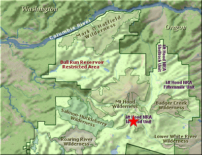
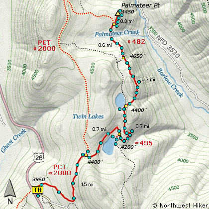
 This hike begins at the Frog Lake trailhead just off Highway 26.
The first mile and a half follow the Pacific Crest Trail #2000. You hike gently
uphill and through a variety of forested areas with Rhododendron in season. At
approximately 1.5 miles, turn right on Trail #495 and follow the well maintained
trail downhill to the first of the Twin Lakes. There are several areas around the
lake that make great viewing and picnicking.
This hike begins at the Frog Lake trailhead just off Highway 26.
The first mile and a half follow the Pacific Crest Trail #2000. You hike gently
uphill and through a variety of forested areas with Rhododendron in season. At
approximately 1.5 miles, turn right on Trail #495 and follow the well maintained
trail downhill to the first of the Twin Lakes. There are several areas around the
lake that make great viewing and picnicking.
One will also note the signs pointing to Frog Lake Butte. This is a vigorous hike,
but not really worth the effort, unless you'd like an alternative route back to
the Frog Lake trailhead. If you hike to the Frog Lake Butte summit, you will find
a newly surfaced road that leads to a newly installed communication tower. You
would do best to walk the road back to the trailhead as the trail of overgrown and
full of windfalls.
 Now, on to the second of the Twin Lakes. Make your way back to Trail #495 and
follow the trail uphill to the upper Twin Lake. Again, most of the hike is in
a forested area. When you reach the upper lake, you should see the top of Mt Hood
peaking over the trees at the north end of the lake.
Now, on to the second of the Twin Lakes. Make your way back to Trail #495 and
follow the trail uphill to the upper Twin Lake. Again, most of the hike is in
a forested area. When you reach the upper lake, you should see the top of Mt Hood
peaking over the trees at the north end of the lake.
If you would like to explore further, there is a good trail that leads from this
upper lake to Palmateer Point. You will find Trail #482 as you begin to walk
around the east side of Upper Twin Lake. Follow this trail for about a half mile
and you will notice a viewpoint just a few feet off the trail to the right. Continue
along the trail downhill to a small creek you will need to cross. Not far past
the creek, is the junction to Palmateer Point. Bear right and climb steeply for
a short distance to the point where you will be rewarded with great views of
Mt Hood and the surrounding valleys.
|