Summary:
Press CTRL + P to print. Photos do not show when you print this page. (Help)
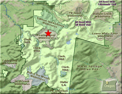
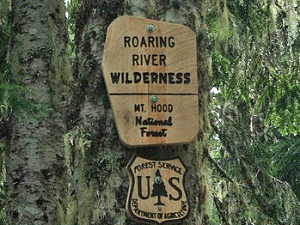 The hike to Shining Lake follows an old abandoned road that led to a fire lookout
tower on Indian Ridge. The tower is no longer there, and the entire area is now
with the new Roaring River Wilderness Area.
The hike to Shining Lake follows an old abandoned road that led to a fire lookout
tower on Indian Ridge. The tower is no longer there, and the entire area is now
with the new Roaring River Wilderness Area.
The hike begins at the Frazier Campground, which is just before the parking area
and trailhead for the Rock Lakes Basin hikes. If you are not staying overnight,
don't park in a fee place, but find an appropriate location and walk to the trailhead
by following the abandoned roadbed. The area is well signed and like I said, most
of this hike simply follows that old road.
As you hike along the road now turned trail, you will from time to time come to places
where you can view the surrounding countryside. However, the vast majority of this hike,
while on the old roadbed is within fairly dense forest. Still, you will discover wild
flowers in season and can even encounter some of the local wildlife. After about four
miles, you will come to an obvious junction on the road/trail. At this point follow
the road/trail to the right which will bring you almost immediately to an old campground,
complete with tables.
 Look carefully to the east side of this area and you will see a trail. This is the trail
you will take down to Shining Lake. It has not been well maintained, but now that this is
a wilderness area and Shining Lake will probably be visited more frequently, the trail is
likely to improve. Anyway, just follow the trail downhill through a series of switchbacks.
You will catch occasional glimpses of the lake as you descend, and eventually the trail
will bring to by what is obviously an area where people have camped.
Look carefully to the east side of this area and you will see a trail. This is the trail
you will take down to Shining Lake. It has not been well maintained, but now that this is
a wilderness area and Shining Lake will probably be visited more frequently, the trail is
likely to improve. Anyway, just follow the trail downhill through a series of switchbacks.
You will catch occasional glimpses of the lake as you descend, and eventually the trail
will bring to by what is obviously an area where people have camped.
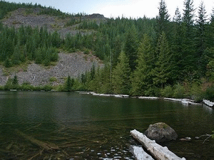
Just leave the trail and walk toward the lake and you can now enjoy the splendor of this
most excellent lake, tucked away in an obscure part of a new wilderness area. The trail
that you were on does continue around the east side of the lake and from time to time
you can approach the lake edge. But all in all the lake does not have great access.
As you continue along the eastern side of the lake, you will come to the outlet, and
if you cross this, you will come to another campsite area.
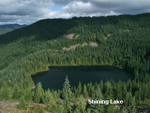 When I explored the area and photographed the lake, I choose to continue on and bushwhack
my way up the north side of the lake and rejoin the trail at that campsite/picnic area
where I began the trail descent to the lake.
When I explored the area and photographed the lake, I choose to continue on and bushwhack
my way up the north side of the lake and rejoin the trail at that campsite/picnic area
where I began the trail descent to the lake.
I cannot recommend this part of the hike. Climbing up the north
side of the lake for great photos is one thing, but trying to get back to the main
trail/road from there is kinda a nightmare. There is no trail, and the brush is extremely
dense and difficult. Therefore, I have labeled this section of the hike GPS ONLY. And
I mean that for folks who actually have experience using their GPS.
However you choose to return, you must make your way back to the road/trail that you
left earlier at the top of the ridge, and walk the road/trail back to your vehicle.
|