Summary:
Press CTRL + P to print. Photos do not show when you print this page. (Help)
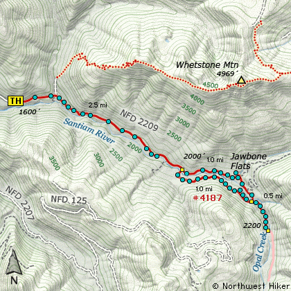
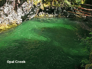
The hike to Jawbone Flats and the Opal Creek
Pools is a fun and enjoyable hike along the
Little North Santiam River.
There are facilities at Jawbone Flats that
can be used to stay overnight if you make
the appropriate reservations.
The trail to Jawbone Flats follows an old
road that is still used to transport items
for those that are staying overnight at the
privately run facilities.
It is about 3 miles of easy road walking to
Jawbone Flats, then a short 1/4 mile to the
wonderful Opal Creek Pools.
You can return part of the way by using the
trail on the south side of the river.
The following images are random samples of the wildflowers found in the Mount Hood National Forest.
Mouseover image to view flower name, and click on image to jump to flower guide.
Travel east of Salem approximately 22 miles to the community of Mehama. Turn left onto North Fork Road,
and follow it for about 15.3 miles where it becomes Forest Road 2209. Continue on FR 2209 for a little
over mile where it forks with FR 2207. Bear left to stay on Forest Road 2209, and follow it another 4
miles to the trailhead. This road is gated at the trailhead, but useable by those who have reservations at Jawbone Flats.
Click on the link below to see a map taking you to the trailhead.