Length: Ride on the Columbia River
Elevation Change: N/A
Season: Year Round
Difficulty: N/A
Permit: Pass Not Required
Features:
This feature is included because of the
unusual opportunity to view the various hike destinations
that are presented on this website from the vantage point
of a boat ride on the Columbia River.
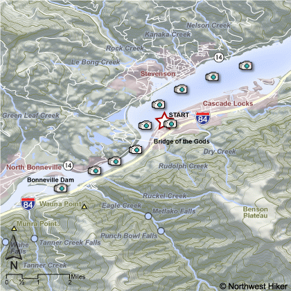
I present the Stern Wheeler ride as being boarded
at the Cascade Locks terminal. The ship goes
downstream beneath the Bridge of the Gods and
turns around on the upstream side of Bonneville
Dam.
Then the ship proceeds upstream for several miles
before looping back to the starting point at
Cascade Locks.
As you become familiar with the various hikes
on this website, you will recognize their locations
as you gaze out over the terrain from this
enjoyable stern wheeler ride. It gives you a
very unique perspective on your hikes and is
well worth the time.
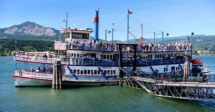 Columbia Gorge Sternwheeler
|