Length: 3 miles RT
Elevation Change: 1000' gain
Season: Early Spring thru Early Winter
Difficulty: Moderate due to elevation gain and length of hike
Permit: Pass Not Required
GPS: N45 42.8052 W121 45.1098
Latitude: 45.71342
Longitude: -121.75183
Features:
NEW!
Click for PDF Topo Map of this Hike
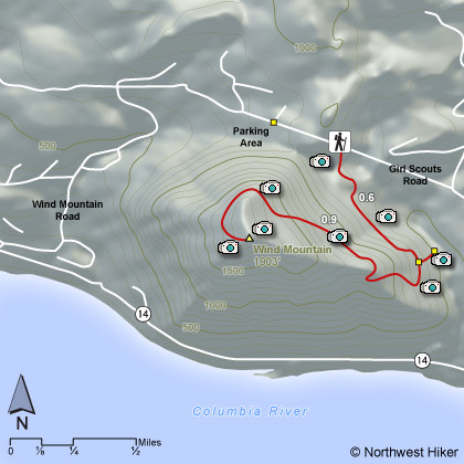
This is one of the least known hikes in the Gorge
yet if offers spectacular views for such a short hike. Parking
at the Trail Head is limited, so park in the designated area shown
on the map. Its only a short walk to the trail itself.
The hike starts out rather steep and often challenges the hiker
with intense grades. However, due to the short length of the
hike, it is only a moderate in difficulty. And the reward is
great.
This is the one hike on this website that has archaeological components.
On the top of Wind Mountain are Native American formations created
by young people during their Spirit Quest. Great care must be
taken not to disturb these ruins.
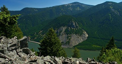 Looking across the Columbia River Gorge at Mt Defiance
from the summit of Wind Mountain
|