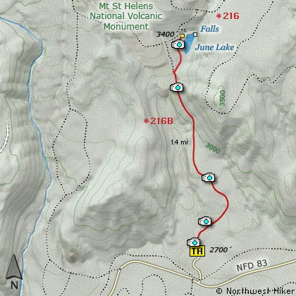
Length: 2.8 Miles round trip
Elevation Change: 700' Elevation gain
Season: Late Spring thru Fall
Difficulty: Moderate
Permit: NW Forest Pass Required
Volcano Alert
Call this number to see if this trail is closed:
360-449-7800
Features:
Here is another little hike that is
rich in rewards with very little
effort. The hike begins at a trail
head just off Forest Road 83. The
trail actually follows an old road for
much of the way.
On a clear day the views of Mt St
Helens from this hike are spectacular.
In season the flowers along the way
are great. But the reward is the
beautiful little June Lake, and
the June Lake Falls. The hike is
never very steep, and there is a
excellent bridge that crosses the
stream that comes out of June Lake.
This trail is also used as a winter
approach to climbing Mt St Helens.
Because of the low elevation of
the trail head, climbs use this
location to climb Mt St Helens
when they can not reach the
established start point of
Climbers Bivouac.
When you arrive at June Lake, you
might be surprised as to how small
the lake is. But this the waterfall
right behind the lake, and with the
beautiful setting of the lake, this
hike is well worth it.
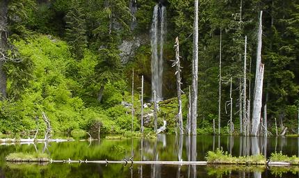
June Lake
|
How to get there:
NEW!
Click for PDF Directions Map of this Hike
From Woodland, WA
From the junction with I-5 follow SR503 east from Woodland, WA approximately 23
miles to the junction of the Lewis River Road with SR503. Continue east on the
Lewis River Road another 4.4 miles to the junction of Forest Road 81 just before
you get to Cougar. Continue east through Cougar on the Lewis River Road, which
becomes Forest Road 90, for about 7.4 miles to the junction of Forest Roads 90 and 83.
Turn left on FR83. In about 1.7 miles you will pass the road that leads to the
Ape Caves, but continue north on FR83. In another 1.3 miles you will come to the
junction to Forest Road 81. Continue on FR83 for another 3.8 miles you will come
to the parking area for the June Lake hike.
|