Length: 3.0 miles round trip
Elevation Change: 776' gain
Season: Summer thru fall
Difficulty: Moderate
Permit: NW Forest Pass Required
Latitude: 46.8156
Longitude: -121.1511
Features:
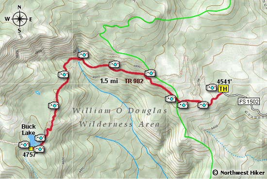
This is not a popular hike, but the trail is often used to
access the Mt. Aix area from the east. Also, the trail no
longer follows the path as shown in most GPS programs.
From the parking area, the trail climbs gently along the
southern flank of a prominent ridge. Most of the hike is
in the forest with occasional views to the south of Shellrock Mtn.
The trail levels out a bit as you approach Buck Lake. The lake
is no spectacular and seems like an overgrown pond or swamp.
Nevertheless, the hike is easy and worth the effort on a good
weather day.

A glimpse of Shellrock Mtn from the Buck Lake trail
|