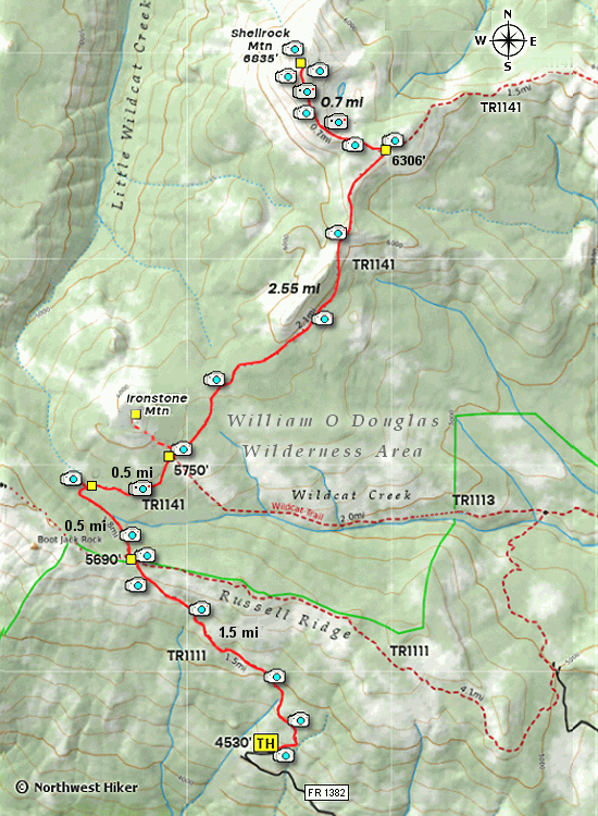
Length: 10.75 miles round trip
Elevation Change: 2828' gain
Season: Summer thru fall
Difficulty: Difficult
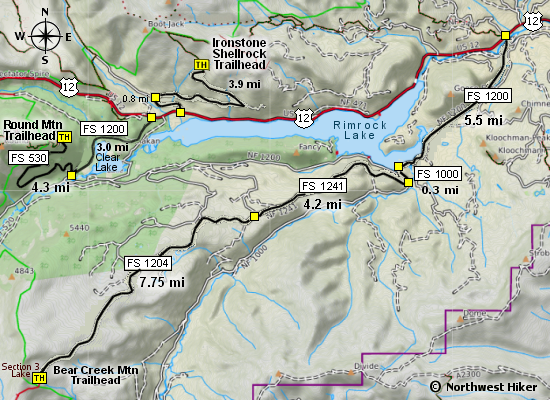
Permit: NW Forest Pass Required
Latitude: 46.6588
Longitude: -121.2356
Features:
This is a very rewarding hike but seldom traveled. There are two main
ways to hike to Shellrock Mountain, from the east and from the south.
This description is the south approach. This hike enters the William O.
Douglas Wilderness, so you must sign in at the trail head.
This description is the same for those hiking Ironstone Mountain up to
the point where one needs to leave the trail and bushwhack up Ironstone.
The parking area at the trailhead for this hike (and Ironstone) is
large and appears to accommodate horses.
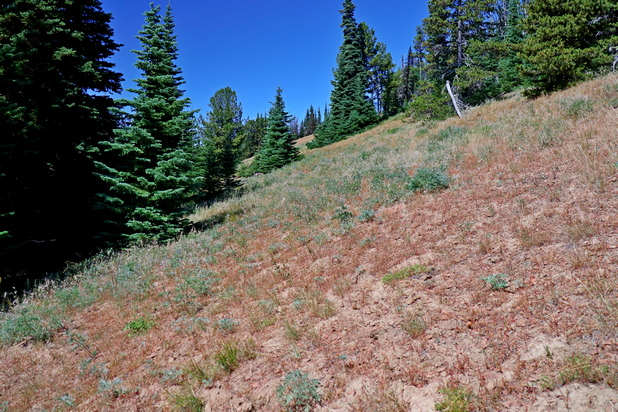
The trail is well marked and begins to climb gently from the parking
area. The trail is in and out of forested areas, so you will often
get glimpse of Mt. Adams and the Goat Rocks to the south and southwest.
The final distance to Russel Ridge gets a little steep but not bad.
At the top of the ridge, the trail is marked but yet it gets a little
sketchy. Trail #1141 descends into a bit of a valley but it is a
little confusing on the ridge as to just where the descend begins.
 Soon the trail is very obvious and it follows a marshy area and crosses
a very small stream. About a half mile from Russel Ridge the trail comes
very close to a wide open meadow with a great view of Ironstone Mountain.
You will have to just walk a very short distance off the trail to enjoy
this vantage.
Soon the trail is very obvious and it follows a marshy area and crosses
a very small stream. About a half mile from Russel Ridge the trail comes
very close to a wide open meadow with a great view of Ironstone Mountain.
You will have to just walk a very short distance off the trail to enjoy
this vantage.
In another half mile you will come to an area that is open and you can
look up at the south side of Ironstone Mountain. This is the place
where a person can ascend Iron Mountain, but to hike to Shellrock,
one must just continue on the main trail northward.
After another mile, the trail makes a brief but steep descent along
the eastern flank of a steep ridge, the slowly climbs back out of
the area and continues on toward the junction to Shellrock Mountain.
Soon the trail comes to a saddle where you catch a good view of Shellrock,
but then continue on toward the junction. At this point, the trail travels
in and out of forested areas, giving you several great views to the east.
 Upon reaching the marked junction to Shellrock Mountain, follow the
designated trail to the west and soon you will begin a steep sketchy
climb upon the ridge of the mountain. Here you get amazing views
of Mt. Adams and Ironstone Mountain to the south as well as the
Goat Rocks. You also get a world class view of Mt. Rainier to the
west.
Upon reaching the marked junction to Shellrock Mountain, follow the
designated trail to the west and soon you will begin a steep sketchy
climb upon the ridge of the mountain. Here you get amazing views
of Mt. Adams and Ironstone Mountain to the south as well as the
Goat Rocks. You also get a world class view of Mt. Rainier to the
west.

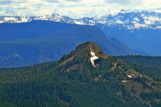
Looking north from Ironstone Mtn with Shellrock on the right
|