Length: Varies
Elevation Change: Varies
Season: Nearly Year-round
Difficulty: Easy to Moderate
Permit: State Park Pass Required
Features:
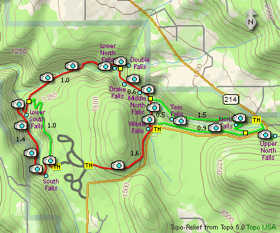
Here is another Oregon State Park gem.
Nearly any season you choose to enjoy
hiking in this park, you will not be
sorry. For this website, I chose to
park in the main parking area and do
a figure eight loop hike which includes most
of the major waterfalls.
I did the hike counter-clockwise. Beginning
at the main parking area, I went east toward
Winter Falls and followed the paved trail
down into the valley. Then I headed east to
North Falls and Upper North Falls. Then I
hiked the Rim Trail back to the top of
Winter Falls, descending again to the bridge.
Then instead of heading east, this time I
went west and completed the figure 8 loop,
ending up at South Falls and the place
where I parked my vehicle. The photos tell you
more than my words, so ENJOY!
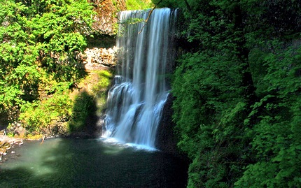
Lower South Falls on Silver Creek
|