


|
THE FOLLOWING MAPS ARE NOT TO BE USED FOR NAVIGATIONAL PURPOSES.
 View the slideshow for more sequential photos of this hike.
|
Length: 13 mile loop
Elevation Change: 2760' gain
Season: Late spring thru fall
Difficulty: Difficult due to steepness of
trail and length of hike
Permit: No Pass Required
Features: 
This robust hike takes you past Multnomah Falls and up Multnomah Creek
where you are rewarded with many beautiful waterfalls. At approximately
1.8 miles you will come to the junction of Trail #420, which bears to the
right and returns to Wahkeena Falls. Stay left, or straight ahead.
 In a little over a mile, the trail comes uncomfortably close to Multnomah Creek,
but if the water is low enough, you will be just fine. Shortly after that
you will come to the junction to the Franklin Ridge Trail #427. Bear left
onto this trail.
In a little over a mile, the trail comes uncomfortably close to Multnomah Creek,
but if the water is low enough, you will be just fine. Shortly after that
you will come to the junction to the Franklin Ridge Trail #427. Bear left
onto this trail.
 Follow this trail through a variety of forest covers and wildflowers
in season for a little over two miles to the junction to Oneonta Gorge.
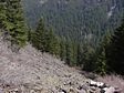
By this point you have gained considerable elevation. There are very few viewpoints
on this hike, but the forest experience is more than worth it.
Follow this trail through a variety of forest covers and wildflowers
in season for a little over two miles to the junction to Oneonta Gorge.
By this point you have gained considerable elevation. There are very few viewpoints
on this hike, but the forest experience is more than worth it.
Note: 2008: This bridge above Triple Falls is out until further notice.
To do this loop, you would have to cross Oneonta Creek at your own peril.
 Bear left onto Trail #424 which decends into the Oneonta Canyon.
After descending into Oneonta Gorge, you follow Oneonta Creek
past fabulous Triple Falls to the junction where you can either complete the hike
one-way by taking the route to Horsetail Falls in which case you will be delighted
by Ponytail Falls, or continue on Gorge Trail #400 back to Multnomah Falls.
Bear left onto Trail #424 which decends into the Oneonta Canyon.
After descending into Oneonta Gorge, you follow Oneonta Creek
past fabulous Triple Falls to the junction where you can either complete the hike
one-way by taking the route to Horsetail Falls in which case you will be delighted
by Ponytail Falls, or continue on Gorge Trail #400 back to Multnomah Falls.
|
|
The following images are random samples of the wildflowers found in the Columbia River Gorge National Scenic Area.
Mouseover image to view flower name, and click on image to jump to flower guide.
|
Directions:
From Portland, OR
From Portland, travel east on Interstate Hwy 84 to Exit
Click on the link below to see a map taking you to the trailhead.
|
|
|
|
 |


