


|
THE FOLLOWING MAPS ARE NOT TO BE USED FOR NAVIGATIONAL PURPOSES.
 View the slideshow for more sequential photos of this hike.
|
Length: 10.2 miles round trip
Elevation Change: 3706' gain
Season: Summer thru fall
Difficulty: Difficult due to steepness of trail
Permit: NW Forest Pass Required
Features: 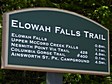
This extremely steep hike offers much to the hiking enthusiast, like
sore leg muscles, pounding heart, gasping lungs, tripping feet, blisters where you didn't
know you could get blisters, and oh yes, did I mention sore leg muscles? Well, if this
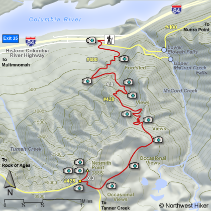
is your cup of tea, go for it! Start at the Elowah Falls trailhead, which begins at
the John B. Yeon state park entrance. A short walk past an old water tower, leads you
to the junction up Nesmith Point.
 Follow Trail #400 toward Nesmith Point until it begins a set up steep switchbacks.
It is at this point that the Nesmith Point trail leaves the now defunk Gorge #400
trail because it was wiped out by flooding a few years ago. It is at this point
that the trail takes on a very steep incline. Trail #428 climbs almost 3000 feet
in about 2.5 miles. Then you continue climbing for another mile and a half
to the junction of this trail with Trail #425.
Follow Trail #400 toward Nesmith Point until it begins a set up steep switchbacks.
It is at this point that the Nesmith Point trail leaves the now defunk Gorge #400
trail because it was wiped out by flooding a few years ago. It is at this point
that the trail takes on a very steep incline. Trail #428 climbs almost 3000 feet
in about 2.5 miles. Then you continue climbing for another mile and a half
to the junction of this trail with Trail #425.
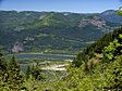
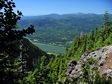 After this junction it is a short hop, skip, and a jump (OK a short crawl) to the top
of Nesmith Point and the truly great view that made this nightmare, I mean hike, worth it.
Be sure your breaks are in good condition for the trip down, cause you know you will need
them.
After this junction it is a short hop, skip, and a jump (OK a short crawl) to the top
of Nesmith Point and the truly great view that made this nightmare, I mean hike, worth it.
Be sure your breaks are in good condition for the trip down, cause you know you will need
them.
|
|
The following images are random samples of the wildflowers found in the Columbia River Gorge National Scenic Area.
Mouseover image to view flower name, and click on image to jump to flower guide.
|
Directions:
From Portland, OR
From Portland, travel east on Interstate Hwy 84 to Exit
Click on the link below to see a map taking you to the trailhead.
|
|
|
|
 |


