


|
THE FOLLOWING MAPS ARE NOT TO BE USED FOR NAVIGATIONAL PURPOSES.
 View the slideshow for more sequential photos of this hike.
|
Length: 10 miles round trip
Elevation Change: 3380' gain
Season: Late Spring thru Fall
Difficulty: Difficult
Permit: NW Forest Pass Required
Features: 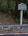
This hike begins at the Wahclella Falls parking lot. Just walk a brief
distance back toward the freeway and you will see the trail on your right taking off up
behind the parking lot. There is a trailhead sign, but it does not mention
Wauna Point, Dublin Lake, or Tanner Butte, yet this is the trail that
leads to all three.
 Follow the trail for about a mile and after crossing under power
lines you will come to a service road which you need to follow south up Tanner Creek
Canyon for about another mile. You will then come to the Tanner Ridge/Butte trailhead.
Follow Trail #401 for about 2.2 miles and 1500' in elevation later you will come to a
junction with the Wauna Point Trail #401D.
Follow the trail for about a mile and after crossing under power
lines you will come to a service road which you need to follow south up Tanner Creek
Canyon for about another mile. You will then come to the Tanner Ridge/Butte trailhead.
Follow Trail #401 for about 2.2 miles and 1500' in elevation later you will come to a
junction with the Wauna Point Trail #401D.
 Bear to your left and follow the UN-MAINTAINED trail through thick
forest toward the Columbia River Gorge. In about a half mile the trail splits, and if
you really want to walk out onto Wauna Point, take the left fork of the trail. The
trail now really deteriorates. Carefully negotiate the obstacle course before you and
work your way down, and down, and down the slope until you finally reach Wauna Point.
Bear to your left and follow the UN-MAINTAINED trail through thick
forest toward the Columbia River Gorge. In about a half mile the trail splits, and if
you really want to walk out onto Wauna Point, take the left fork of the trail. The
trail now really deteriorates. Carefully negotiate the obstacle course before you and
work your way down, and down, and down the slope until you finally reach Wauna Point.
 Oh, yeah, you'll know when you've arrived... one more step and you'll be back at your
car. The return trip, of course, required that you climb back up the steep slopes you
just descended. But, hey, you're a hiker, and it's worth it!!!
Oh, yeah, you'll know when you've arrived... one more step and you'll be back at your
car. The return trip, of course, required that you climb back up the steep slopes you
just descended. But, hey, you're a hiker, and it's worth it!!!
Use Extreme Caution.
You are climbing out on a several hundred foot cliff.
|
|
The following images are random samples of the wildflowers found in the Columbia River Gorge National Scenic Area.
Mouseover image to view flower name, and click on image to jump to flower guide.
|
Directions:
From Portland, OR
From Portland, travel east on Interstate Hwy 84 to Exit
Click on the link below to see a map taking you to the trailhead.
|
|
|
|
 |


