


|
THE FOLLOWING MAPS ARE NOT TO BE USED FOR NAVIGATIONAL PURPOSES.
 View the slideshow for more sequential photos of this hike.
|
Length: 12.0 miles round trip
Elevation Change: 1050' gain
Season: Year Round
Difficulty: Challenging due to length of hike
Permit: NW Forest Pass Required
Features: 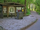
This is beyond a doubt one of the most popular hikes in Oregon, not to mention
the Columbia River Gorge. And rightly so. This hike is unique in many ways
and so worth the time and effort. The trail begins at the Eagle Creek Trailhhead
just a short distance from the fish hatchery at exit 41 off I84 eastbound. Remember,
there is no exit for Eagle Creek from I84 westbound.
 The Eagle Creek trail follows the creek very closely and at times is cut out of the
basalt rock walls that form the canyon through which the creek flows.
At 2 miles you will come to Punchbowl Falls, and at 3.2 miles you will reach the
High Bridge. After crossing the High Bridge, the trail continues upstream for another
2.8 miles to the fantastic Tunnel Falls. So names because the trail builders decided to carve
a tunnel out of the sheer rock wall, over which the falls descends, for hikers to pass by
the falls.
The Eagle Creek trail follows the creek very closely and at times is cut out of the
basalt rock walls that form the canyon through which the creek flows.
At 2 miles you will come to Punchbowl Falls, and at 3.2 miles you will reach the
High Bridge. After crossing the High Bridge, the trail continues upstream for another
2.8 miles to the fantastic Tunnel Falls. So names because the trail builders decided to carve
a tunnel out of the sheer rock wall, over which the falls descends, for hikers to pass by
the falls.
But there's more. If you walk a short distance past Tunnel Falls, you come
to another treat, falls on Eagle Creek itself.

|
|
|
The following images are random samples of the wildflowers found in the Columbia River Gorge National Scenic Area.
Mouseover image to view flower name, and click on image to jump to flower guide.
|
Directions:
From Portland, OR
From Portland, travel east on Interstate Hwy 84 to Exit
Click on the link below to see a map taking you to the trailhead.
|
|
|
|
 |


