


|
THE FOLLOWING MAPS ARE NOT TO BE USED FOR NAVIGATIONAL PURPOSES.
 View the slideshow for more sequential photos of this hike.
|
Length: 5.6 miles round trip
Elevation Change: 2660' gain
Season: Spring thru Fall
Difficulty: Difficult due to steepness of trail
Permit: NW Forest Pass Required
Features: 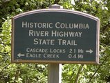
This hike begins at the Eagle Creek hatchery parking lot. Follow the
signs past the campground to Ruckel Creek, not Ruckel Ridge. You will walk a short distance
on a paved part of the Old Columbia River Hwy that has been resurfaced for bicyclists and
hikers. In about a half mile you will come to Ruckel Creek Trail #405.
The Ruckle Creek trail is among the steepest trails in the Columbia River Gorge
hiking areas. It ranks right up there with Nesmith Point, Nick Eaton Ridge,
Dog Mountain, Warren Lake, and Mt. Defiance.
 This is a very steep trail with great reward for those you survive the 15 switchback part of the hike.
As you struggle up the 15 switchbacks, when you come to number 10, you will be
presented the best view of the whole hike. You will look right down at the
Columbia River and all points north, including the Bridge of the Gods, and
Mt. Adams to the northeast. This is a great place to rest, rehydrate, and
build up courage to continue your adventure.
This is a very steep trail with great reward for those you survive the 15 switchback part of the hike.
As you struggle up the 15 switchbacks, when you come to number 10, you will be
presented the best view of the whole hike. You will look right down at the
Columbia River and all points north, including the Bridge of the Gods, and
Mt. Adams to the northeast. This is a great place to rest, rehydrate, and
build up courage to continue your adventure.
The reward is a hanging garden of flowers in the spring and great vistas all year round.
This trail is the main route to Benson Plateau for the more adventurous.

|
|
|
The following images are random samples of the wildflowers found in the Columbia River Gorge National Scenic Area.
Mouseover image to view flower name, and click on image to jump to flower guide.
|
Directions:
From Portland, OR
From Portland, travel east on Interstate Hwy 84 to Exit
Click on the link below to see a map taking you to the trailhead.
|
|
|
|
 |


