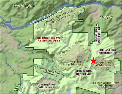
Summary:
Press CTRL + P to print. Photos do not show when you print this page. (Help)
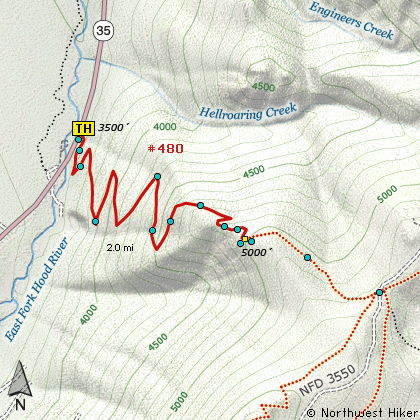
This is a short but challenging hike. The hike begins to climb almost
immediately and climbs along the side of a steep hillside within a dense forest. About
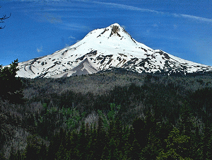
half way to the viewpoint you get your first glimpse of Mt Hood, mostly visible through
the trees. Then as you round the corner to the viewpoint itself, you begin to enjoy what
made the steep climb worth it. The views of Mt Hood and the valley below are outstanding.
This same trail continues on to Gumjuwac Saddle and then on to Lookout Mountain.
About the name of this hike and saddle.... Gumjuwac. According to the sign at the top
of the saddle, the place is named after a shepherd named Jack, who wore gum shoes. They
supposedly called him gum shoe Jack.... thus Gumjuwac....whatever???
The following images are random samples of the wildflowers found in the Mount Hood National Forest.
Mouseover image to view flower name, and click on image to jump to flower guide.
Whether you approach this from on Hwy 35
going south out of Hood River, or if you
are coming north from Hwy 26 near Government
Camp, watch for the bridge near what was
the Robin Hood Campground.
The trailhead is on the east side of the
road and on the north side of the bridge.
Click on the link below to see a map taking you to the trailhead.