Summary:
Press CTRL + P to print. Photos do not show when you print this page. (Help)
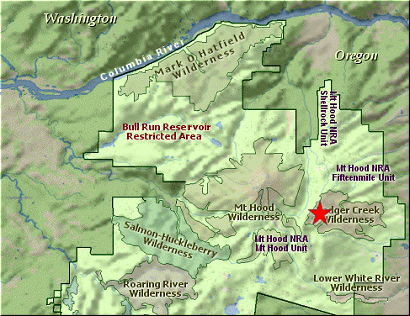
 As is obvious, there are a couple of ways to do the Badger Lake. Because
I've already covered the Gumjuwac Saddle hike on this CD (see Hike 50),
I'll write this narrative from Gumjuwac Saddle.
As is obvious, there are a couple of ways to do the Badger Lake. Because
I've already covered the Gumjuwac Saddle hike on this CD (see Hike 50),
I'll write this narrative from Gumjuwac Saddle.
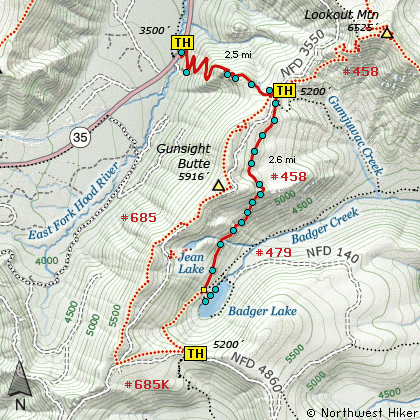
Trail #458 is across the road from where you park and a bit south. Don't get mixed up
with Trail #480, which is a bit to the north of Trail #458. Your Trail #458 climbs for just
a short distance before descending into the valley below. You will be hiking mostly
in a timbered environment. From time to time you will have brief views of the surrounding
areas, but for the most part, you'll be hiking in forest for about the first mile and a half.
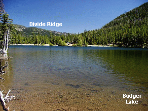
At about 1.5 miles, you'll begin the serious descent into Badger Lake. For a while you'll be
hiking in a more open area with some great vistas or the eastern Oregon flatland to the east,
and of Badger Lake itself
below you. You will also be able to catch glimpses of Mt Jefferson
peeking over the horizon to the south.
 At about 2.6 miles you'll come to the junction of Trails #458 and #479. Just keep straight
ahead and follow the little used Trail #458 to the lake shore. There is an unmaintained
road to Badger Lake, so you'll see vehicles across the lake from where you are. To return
to your vehicle, just reverse your journey and enjoy.
At about 2.6 miles you'll come to the junction of Trails #458 and #479. Just keep straight
ahead and follow the little used Trail #458 to the lake shore. There is an unmaintained
road to Badger Lake, so you'll see vehicles across the lake from where you are. To return
to your vehicle, just reverse your journey and enjoy.
|