|
Features:
This is another gem of a hike in the Mt. Rainier National Park. This hike is so popular that on a good weather day,
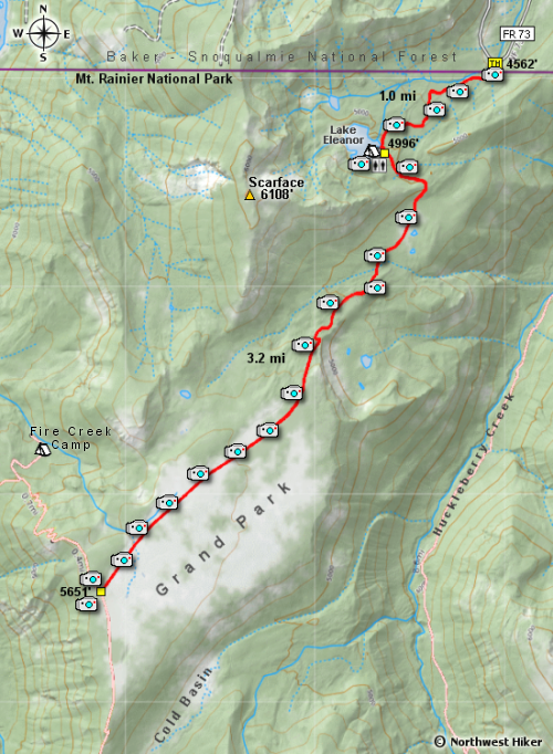
it might be difficult to find a place to park at the trailhead. The trailhead for this awesome hike begins 10 miles
from SR 410 on Forest Road 73 at the trailhead for Eleanor Lake.
 The hike begins in a rather densely forested area, and after a mile it comes to Eleanor Lake. This beautiful lake
has a camp area and a toilet facility.
The hike begins in a rather densely forested area, and after a mile it comes to Eleanor Lake. This beautiful lake
has a camp area and a toilet facility.
After the lake, the trail climbs a small hill before dropping down to a small stream and meadow. From this
meadow you get your first peak at Mt. Rainier.
 After the meadow, the trail once again travels uphill through a densely forested area. In about another
mile, the trail begins to be more in the open as the meadow areas keep getting larger and larger.
Once the trail is totally out in the open meadows, the views are world class and in season the
wildflowers are incredible.
After the meadow, the trail once again travels uphill through a densely forested area. In about another
mile, the trail begins to be more in the open as the meadow areas keep getting larger and larger.
Once the trail is totally out in the open meadows, the views are world class and in season the
wildflowers are incredible.
 If you walk all the way to the western end of Grand Park, you will come to a junction with the northern loop trail,
which is an alternate route for the Wonderland Trail. If you follow the trail north towards Mt. Rainier, you will
soon come to a meadow where you get more fantastic views. Fremont Mountain with its lookout tower are planely
visible from most of the areas of Grand Park.
If you walk all the way to the western end of Grand Park, you will come to a junction with the northern loop trail,
which is an alternate route for the Wonderland Trail. If you follow the trail north towards Mt. Rainier, you will
soon come to a meadow where you get more fantastic views. Fremont Mountain with its lookout tower are planely
visible from most of the areas of Grand Park.

The trail through Grand Park offers world class views of Mt. Rainier.
|


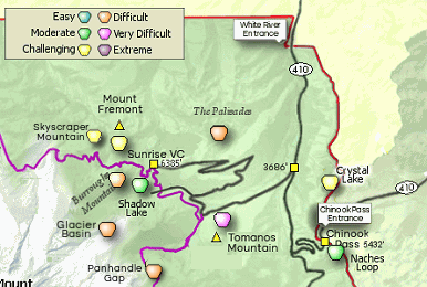


 Whether you come from the north or south on SR410, watch for Forest Road 73 and follow this
road all the way to the trailhead.
Whether you come from the north or south on SR410, watch for Forest Road 73 and follow this
road all the way to the trailhead.
