Length: 1.65 miles round trip
Elevation Change: 623' gain
Season: Summer thru fall
Difficulty: Challenging
Permit: NW Forest Pass Required
Latitude: 46.9175
Longitude: -121.2331
Features:
This is a bit of an unusual hike, in that the trail doesn't
actually take you to the top of Kloochman Rock. I believe
that to reach the summit, one must be a skilled rock climber.
However, this illustrated hike, does get you high on the western
front of Kloochman, and is well worth the effort.
The trail begins just off FR1201, as a spur road itself. For the
first quarter mile, you will walk down an abandoned road which ends
in a wider meadowy area. You can see the trail off to the right,
which will then lead you downhill on it's way to the western face
of Kloochman Rock. In season this area is very floral.
After a bit of a decline, the trail then begins a rather steep climb
up onto the western face of the rock. There area a lot of great
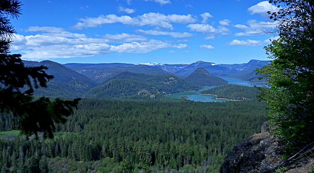
views to the southwest and west where you can see Rimrock Lake below you.
There is no labeled or designated end of the trail, but it simply
stops being a trail.

Looking west towards Rimrock Lake from the Kloochman Rock trail
|

