THE FOLLOWING MAPS ARE NOT TO BE USED FOR NAVIGATIONAL PURPOSES.
View the slideshow for more sequential photos of this hike.
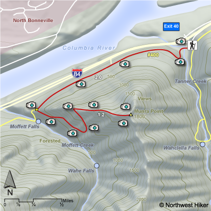
Length: 5.0 miles round trip Elevation Change: 1700' gain Season: Spring thru Fall Difficulty: Very Difficult due to extreme steepness of trail Permit: NW Forest Pass Required Features:
There are a number of ways to approach the steep climb up Munra Point.
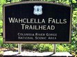
One can either begin at the Wahclella Falls parking lot and hike
west along the freeway, or one can start at the Elowah Falls
trailhead and hike east. The trail from Wahclella Falls
trailhead is shorter.
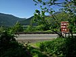
Some people park along the freeway at
the east end of the Moffett Creek bridge, but I would not advise
that. However you get to the base of the Munra Point climb, be
prepared for one of the steepest climbs anywhere in the gorge.
You ascend almost 1700' in just over a mile. In places the
trail is barely visible, and you have to climb hand over foot,
clinging to branches of nearby trees to make it up some areas of the
"trail". The top of the point is very narrow and quite
dangerous.
This hike is NOT family or pet friendly.
THIS IS NOT A HIKE for wet weather.
One slip on this hike and you could really
be injured. REMEMBER, this is NOT a
designated or maintained trail.
The following images are random samples of the wildflowers found in the Columbia River Gorge National Scenic Area.
Mouseover image to view flower name, and click on image to jump to flower guide.


 View the slideshow for more sequential photos of this hike.


 Some people park along the freeway at
the east end of the Moffett Creek bridge, but I would not advise
that. However you get to the base of the Munra Point climb, be
prepared for one of the steepest climbs anywhere in the gorge.
You ascend almost 1700' in just over a mile. In places the
trail is barely visible, and you have to climb hand over foot,
clinging to branches of nearby trees to make it up some areas of the
"trail". The top of the point is very narrow and quite
dangerous.
Some people park along the freeway at
the east end of the Moffett Creek bridge, but I would not advise
that. However you get to the base of the Munra Point climb, be
prepared for one of the steepest climbs anywhere in the gorge.
You ascend almost 1700' in just over a mile. In places the
trail is barely visible, and you have to climb hand over foot,
clinging to branches of nearby trees to make it up some areas of the
"trail". The top of the point is very narrow and quite
dangerous.
 This hike is NOT family or pet friendly.

