


|
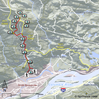
THE FOLLOWING MAPS ARE NOT TO BE USED FOR NAVIGATIONAL PURPOSES.
 View the slideshow for more sequential photos of this hike.
|
Length: 8 miles
Elevation Change: 3200' gain
Season: Late spring thru fall
Difficulty: Difficult
Permit: NW Forest Pass Required
Features: 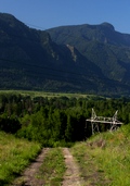
This is a hike that I've always promoted begining at the Bonneville
Dam trailhead. However, since I hiked this hike from the same
trailhead as Aldrich Butte, well, I just don't see any sense in
telling hikers that the only way to hike this mountain is the hard way.
There are those who feel as though we might be tresspassing by approaching
either Table Mountain or Aldrich Butte from the powerline road, but I see
this hike promoted by those who have businesses in the gorge, so I would
imagine as long as we are civil and leave no debris, all will be well.
 Having said that, let's talk about the hike.
The beginning of this hike from the powerline road is on an old
abandoned road. Over time this road has been rutted and overgrown
but still represents an excellent approach to Table Mountain.
At about three quarters of a mile you will see the road to
Aldrich Butte. Keep straight ahead and continue to climb. At
approximately 2 miles you will encounter the Pacific Crest Trail.
Having said that, let's talk about the hike.
The beginning of this hike from the powerline road is on an old
abandoned road. Over time this road has been rutted and overgrown
but still represents an excellent approach to Table Mountain.
At about three quarters of a mile you will see the road to
Aldrich Butte. Keep straight ahead and continue to climb. At
approximately 2 miles you will encounter the Pacific Crest Trail.
Follow the PCT for another mile and you will cross over a ridge
where you will see a users trail leaving the PCT and headed up
Table Mountain. Follow this trail. It is at this point that
the hike up Table Mountain becomes a difficult endeavor.
The trail up this mountain is interesting and fun.
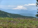 When you arrive at the summit, you will be pleasantly surprised.
The top of basically level and three sided. Bear to the left
and walk along the western flank until you reach a point of
the triangle on the north. Depending on the weather, you
can see Mt. Adams, Mt. Rainier, and Mt. St. Helens from this
end.
When you arrive at the summit, you will be pleasantly surprised.
The top of basically level and three sided. Bear to the left
and walk along the western flank until you reach a point of
the triangle on the north. Depending on the weather, you
can see Mt. Adams, Mt. Rainier, and Mt. St. Helens from this
end.
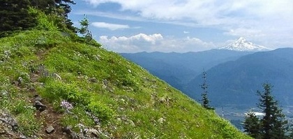
Then follow a trail to the point on the southeastern side of the mountain.
Here you will be standing at the abrupt cliff face of Table Mountain, so
use extreme caution. This is a dangerous place to be. The views, of
course, are magnificent. On a clear day you can see Mt. Hood to the south.
You can return to the trail you used to get on top of the mountain
by walking westward, but instead of going back to the north point,
just bushwack a very short distance and you will come to that trail.
Desend accordingly.
|
|
|
The following images are random samples of the wildflowers found in the Columbia River Gorge National Scenic Area.
Mouseover image to view flower name, and click on image to jump to flower guide.
|
Directions:
From Portland, OR
From Portland, travel east on Interstate Hwy 84 to Exit
Click on the link below to see a map taking you to the trailhead.
|
|
|
|
 |


