THE FOLLOWING MAPS ARE NOT TO BE USED FOR NAVIGATIONAL PURPOSES.
View the slideshow for more sequential photos of this hike.
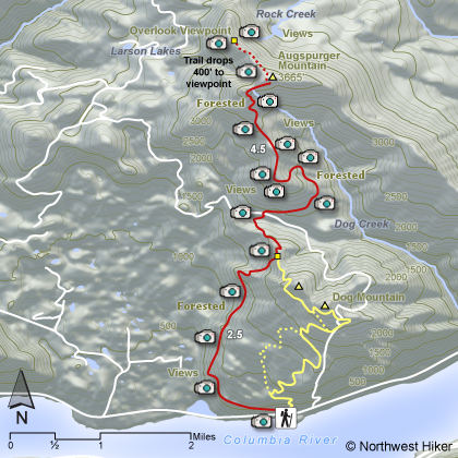
Length: 16 miles RT to summit including 1 mile RT to overlook Elevation Change: 4400' cummulative gain Season: Spring
thru Fall Difficulty: Very Difficult due to length of hike and
elevation gains and losses Permit: NW Forest Pass Required Features:
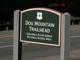
This hike begins in the middle of the Dog Mtn trailhead along Washington
highway 14. This trail is nearly three times as long as the Dog Mountain
hike and is definately three times as challenging.
It is a long steady hike in and out of forested areas up the western
flank of Dog Mountain.
At 2.8 miles you come to the junction with Dog Mtn, so
continue straight ahead and down hill. You loose about 400' elevation. In
about half mile you come to a power line service road which you will follow
for about another half mile. The trail then takes off into the deep woods and begins
to do some serious climbing.
In another mile you will break out onto a ridge
that parallels the high-power lines. From this ridge you have many spectacular
views as you continue to climb. There are some short switchbacks that take you
in and out of the forested areas as you climb the steeper part of this hike.
Finally you reach the heavily forested top of Augspurger.
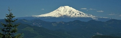
If you continue down
hill on a faint trail on the northwest side of the mountain, you will come
out onto an exposes slope with fantastic views and more than worth the hike.
The following images are random samples of the wildflowers found in the Columbia River Gorge National Scenic Area.
Mouseover image to view flower name, and click on image to jump to flower guide.


 View the slideshow for more sequential photos of this hike.


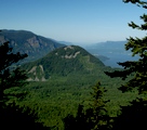 In another mile you will break out onto a ridge
that parallels the high-power lines. From this ridge you have many spectacular
views as you continue to climb. There are some short switchbacks that take you
in and out of the forested areas as you climb the steeper part of this hike.
Finally you reach the heavily forested top of Augspurger.
In another mile you will break out onto a ridge
that parallels the high-power lines. From this ridge you have many spectacular
views as you continue to climb. There are some short switchbacks that take you
in and out of the forested areas as you climb the steeper part of this hike.
Finally you reach the heavily forested top of Augspurger.